

The house was not the whole property.
This project was a lesson in visual hierarchy: when a listing is built around land, structures and lifestyle, the media must explain the complete system—not just its square footage.
That sounds obvious when a listing sits on more than four acres.
But it is surprisingly easy to photograph an acreage property almost exactly like a suburban home: front exterior, kitchen, living room, bedrooms, backyard—and then add a few drone images at the end.
That approach would not have explained this property.
The home mattered. So did the land, the workshop, covered storage, open space and the physical relationship between all of those elements.
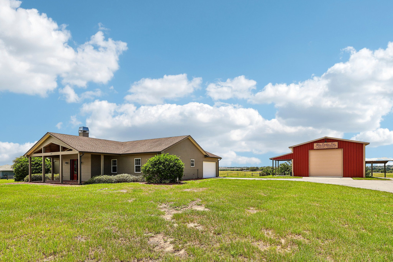 From ground level, the home and workshop already suggest that this property is different from a typical residential lot. But the full relationship between the structures and acreage requires another perspective.
This Listing Was Not Really About 1,744 Square Feet
The property at 3670 Lake Hatchineha Rd in Haines City sits on approximately 4.54 acres.
The residence itself is a 2-bedroom, 3-bath home of approximately 1,744 square feet, built in 2018.
If I built the gallery around square footage alone, I would be emphasizing the wrong part of the listing.
The land and auxiliary structures were not background.
They were part of the product.
For acreage listings, the question changes.
It is no longer only, “What does the house look like?”
It becomes, “How does this entire property work?”
The Property Had Five Visual Stories
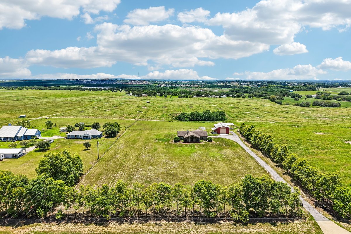 A wider aerial frame adds landscape context and sense of scale. It is visual context—not a survey or a representation of legal boundaries.
The primary living spaces and residential experience.
The amount, openness and overall character of the acreage.
A structure with a completely different practical function.
Covered space that could accommodate larger vehicles or equipment.
Where the home, structures, access and open areas sit relative to one another.
Why Ground-Level Photos Were Not Enough
Standing beside the house, I could photograph the house.
Standing near the workshop, I could photograph the workshop.
I could photograph covered storage, open areas and individual exterior features from the ground as well.
But each photograph would still isolate one piece of the property.
Useful for architecture, condition, materials and a human-scale view of the building.
Useful for understanding how multiple structures and open areas are positioned together.
One perspective should not replace the other. The information is different.
That distinction is important.
Drone photography was not valuable here simply because the lot was large.
It was valuable because there was a specific visual question that ground photography could not answer well.
The Aerial Image That Explained the Property
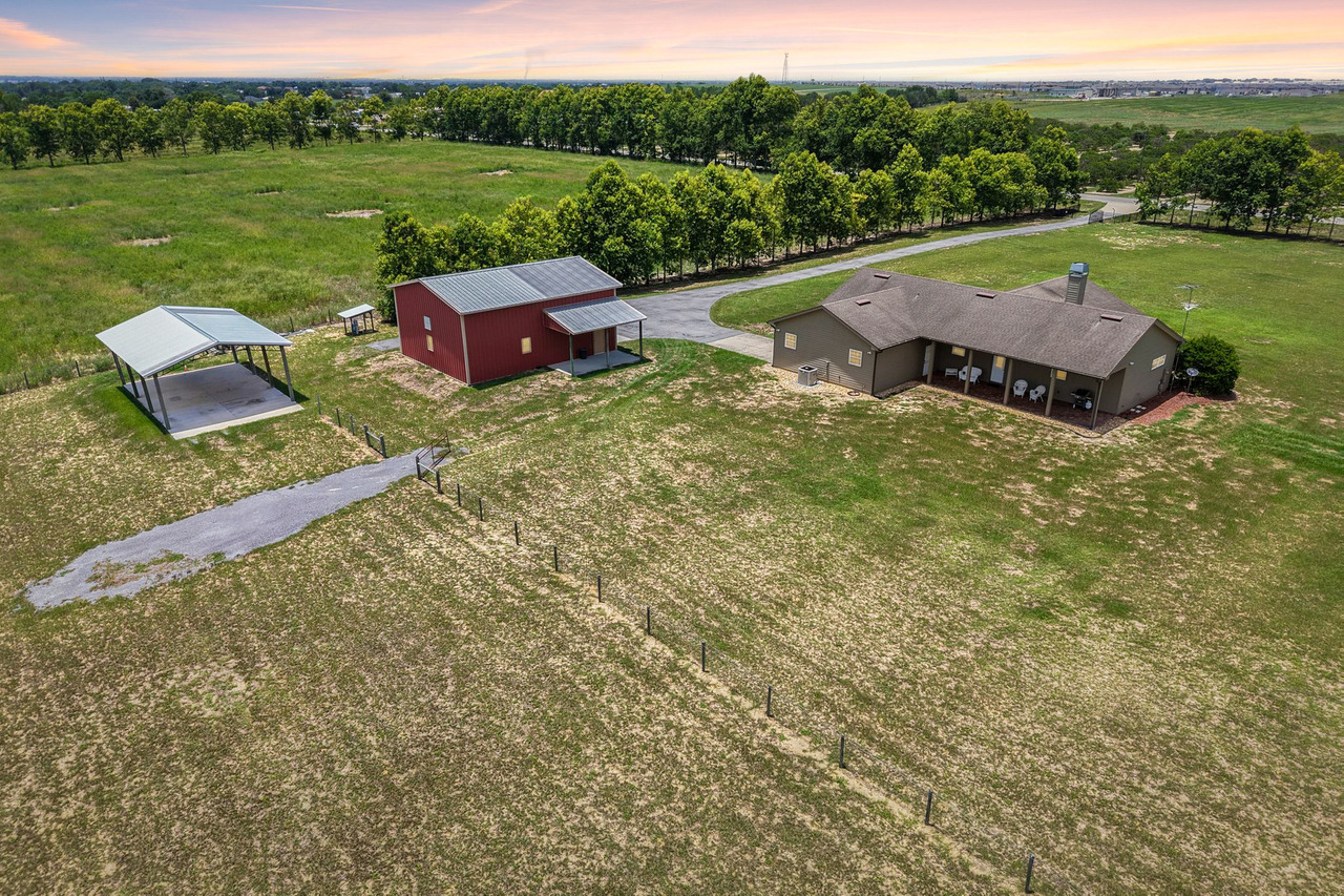 This is the type of aerial frame I look for on an acreage property: not simply “the house from above,” but a photograph that explains how the major parts of the property relate to each other.
In one view, the buyer can begin to understand the scale of the property, where the residence sits, where the auxiliary structures are located and how much open land surrounds them.
That is information.
Not decoration.
On larger properties, I usually do not begin by asking, “How high can I fly?”
I ask, “What relationship cannot be understood from the ground?”
Sometimes the useful aerial is relatively low because the structures still need to feel recognizable.
Higher is not automatically better.
Do Not Bury the Outbuildings at the End of the Gallery
One mistake I would avoid on a property like this is treating the workshop and covered storage as secondary extras.
They may be secondary to the residence in a legal or architectural sense.
That does not automatically make them secondary to the buyer.
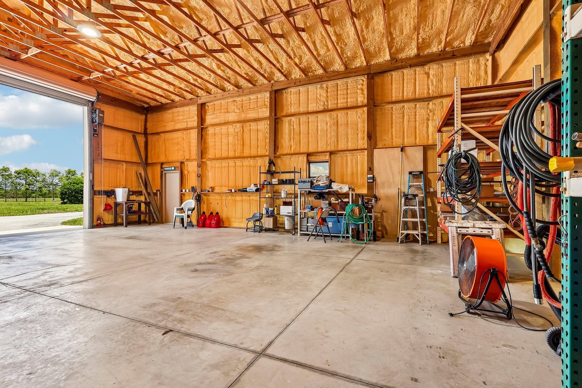 The workshop is not background space. Its clear floor area, functional fit-out and open access give a buyer a concrete sense of what the property can support.
That is why the gallery should give these structures enough visual attention to answer basic questions.
What is it?
Where is it?
How does it relate to the house?
How much open area surrounds it?
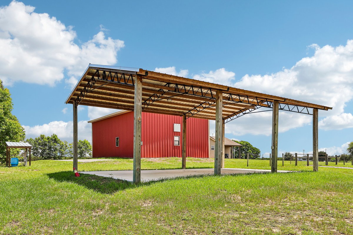 Covered storage, workshop and open acreage read differently when they are shown as connected assets—not isolated extras at the end of a gallery.
The goal is not to exaggerate the structures.
The goal is to avoid accidentally hiding part of what the property offers.
The House Still Has to Hold Its Own
There is a danger in talking so much about acreage that the residential part of the listing becomes an afterthought.
That would be the opposite mistake.
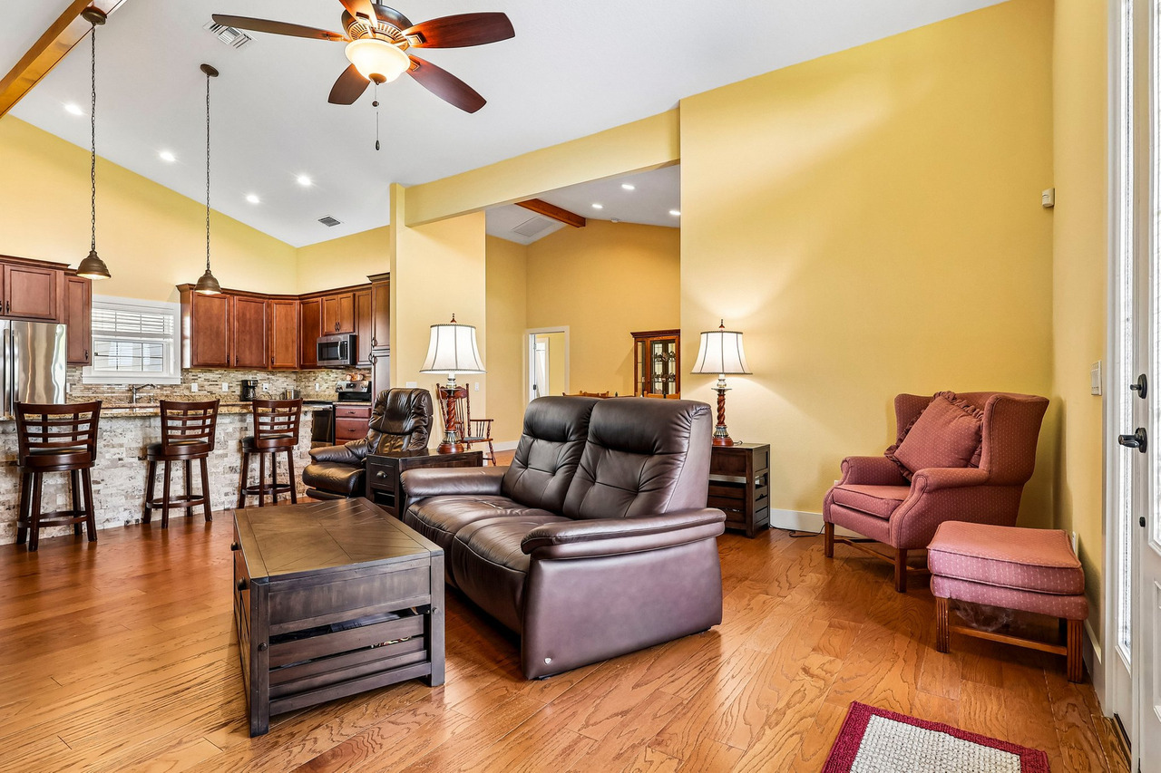 The interior still needs the same discipline as any residential listing: controlled perspective, believable color and compositions that help the viewer understand the room.
Once I am inside, the acreage does not excuse weak interior photography.
The living spaces still have to be photographed clearly.
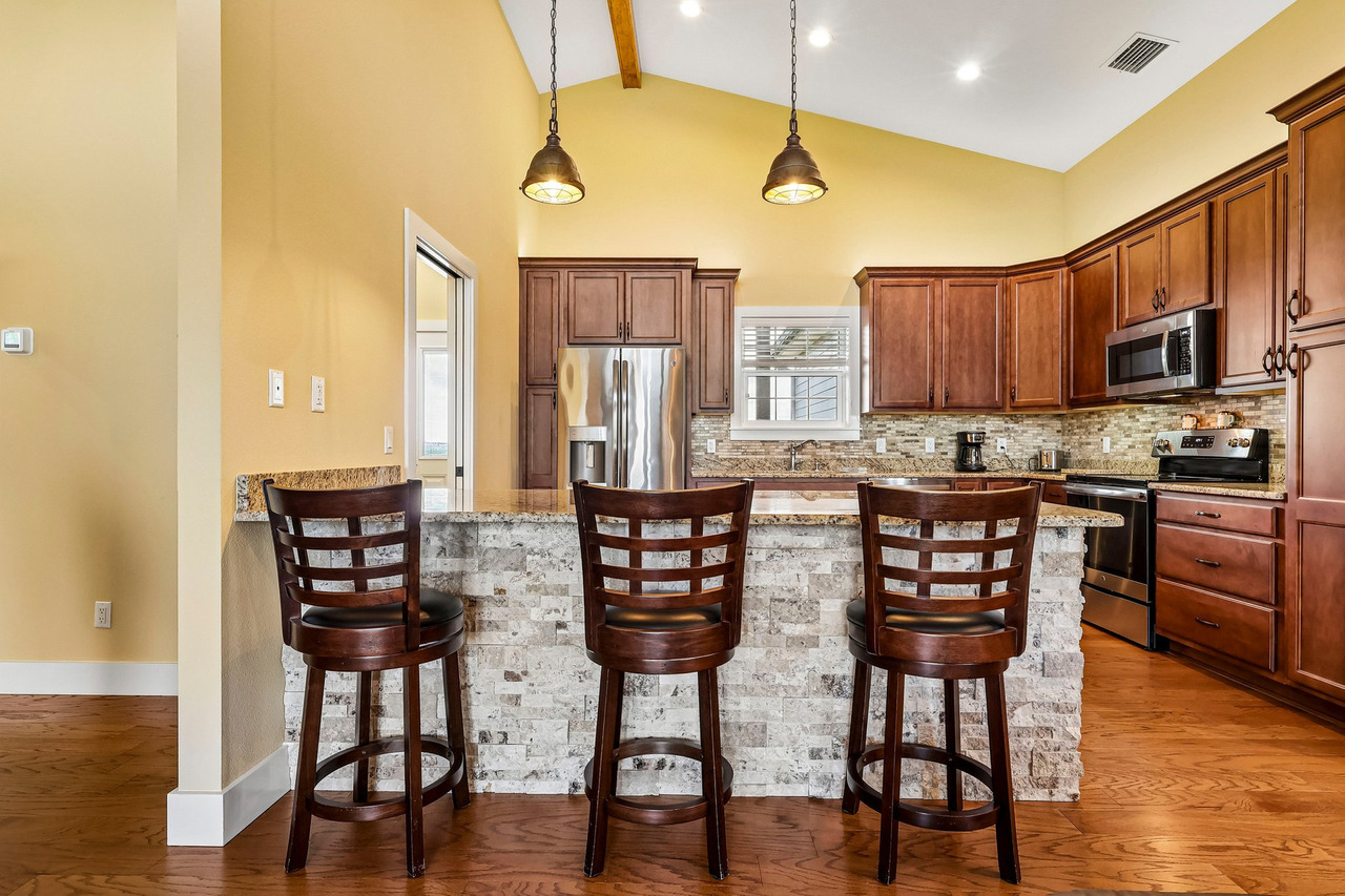 The kitchen has a different job from the drone image. One explains the residential experience; the other explains the larger property.
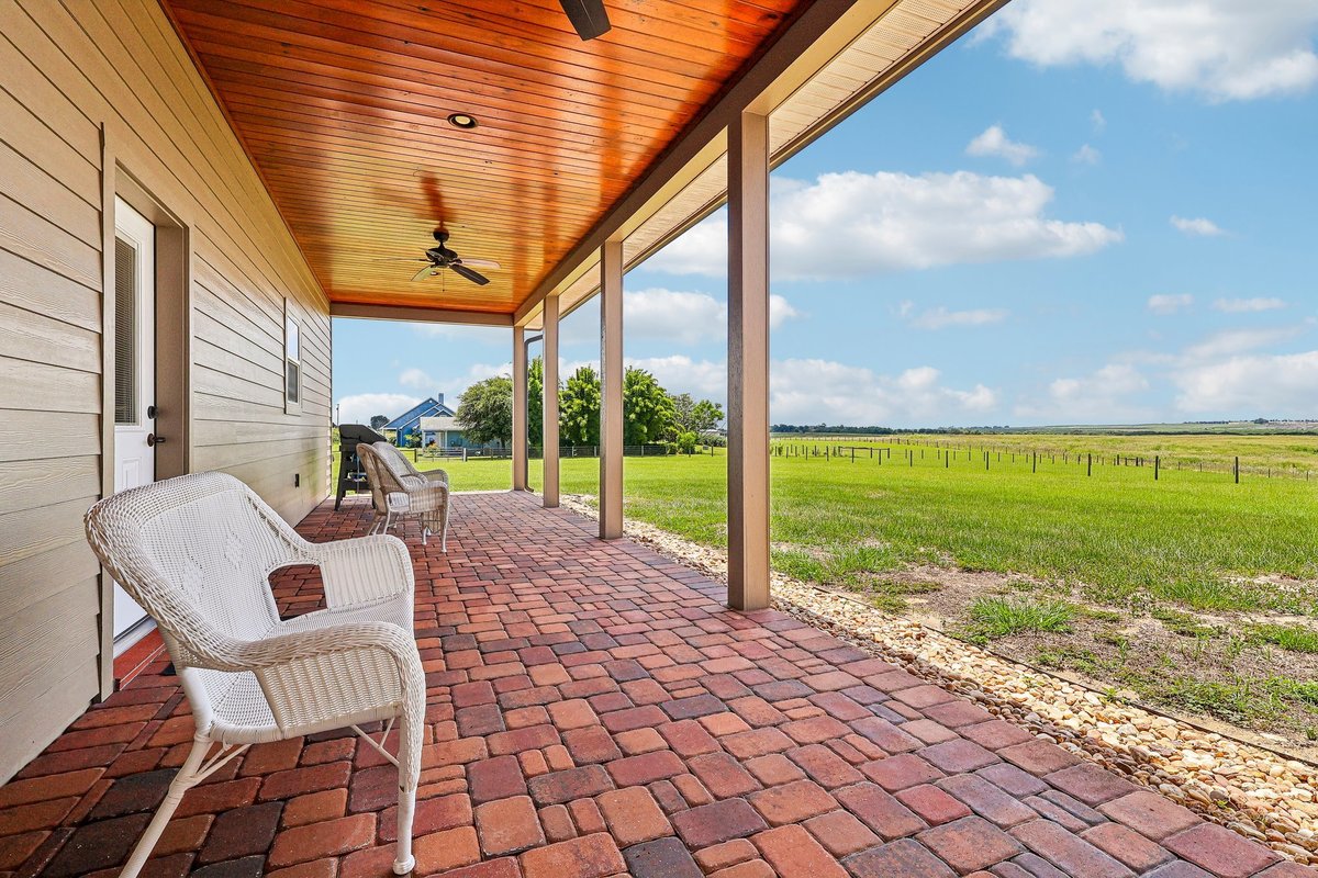 The residential experience is not limited to interiors. The porch opens the house back into the acreage lifestyle around it.
How I Would Sequence an Acreage Gallery
Acreage listings need more intentional sequencing because there are several visual stories competing for attention.
I do not want fifty images of the house followed by ten aerials and then the workshop hidden near the end.
A Practical Acreage Gallery Flow
- Open with the strongest overview.
- Establish the house.
- Introduce the relationship between structures.
- Move through the main interior spaces.
- Return to the property features.
- Use aerials to expand context.
- Finish with supporting views.
That sequence is not a universal formula.
It is a way of thinking about hierarchy.
The most important information should not be buried simply because the photographer walked through the house first.
What Drone Photography Can Show—and What It Cannot Prove
Aerial imagery is powerful on acreage, but there is an important boundary.
Open space, roads, tree lines, relative positions of structures and the general relationship between the property and its surroundings.
A photograph is not a survey. Visual impressions should not be presented as verified property lines unless accurate boundary data is supplied and clearly disclosed.
How the home, workshop, covered storage and other visible features appear to relate spatially.
An aerial photograph does not replace inspections, zoning verification, permits or other professional due diligence.
Good real estate media should reduce uncertainty without creating false certainty.
A Realtor Checklist for Acreage Media
Before the Photographer Arrives, Ask:
- What matters besides the house?
- Which features could be missed from ground level?
- Does the land have a visual story?
- Are there structures the buyer may consider highly important?
- What claims require verification?
- Can the buyer understand how everything connects?
- Does drone photography have a specific job?
What This Project Taught Me
The strongest lesson from this Haines City property is not that acreage homes need more photographs.
They often need a different type of thinking.
First understand what the buyer is actually evaluating across the complete property.
The aerial should explain scale or spatial context, not simply repeat the front exterior from a higher angle.
Workshop and storage spaces can be strategically important to the right buyer.
Acreage does not reduce the need for disciplined interior photography.
Gallery order should reflect property hierarchy, not simply the order in which the photos were captured.
Photography explains what can be seen. Surveys, records and inspections verify what photography cannot.
And that is what changes the media strategy.
Frequently Asked Questions
Does every acreage listing need drone photography?
No. Drone photography is especially useful when aerial perspective explains scale, spatial relationships, access, open areas or other context that cannot be communicated effectively from the ground.
Should the house still be the first image?
Not automatically. The first image should usually communicate one of the strongest reasons to open the listing. On some acreage properties that may be the residence; on others, an overview may communicate the property more effectively.
Can drone photos show property lines?
Aerial photographs can show visible land context, but they should not be treated as legal surveys. If boundary overlays are used, they should be based on appropriate source data and clearly presented as informational rather than survey-grade.
How many aerial photos should an acreage listing include?
There is no useful universal number. Each aerial should add information. Multiple nearly identical high-altitude photographs may make the gallery longer without helping the buyer understand the property.
Should workshops and storage buildings be photographed professionally?
If they are meaningful features of the property, yes. The coverage does not need to be identical to the main residence, but buyers should be able to understand what the structures are and how they relate to the rest of the property.
What is the biggest difference between photographing acreage and a suburban home?
A suburban listing is often primarily about the residence. An acreage property may require the media to explain several interconnected assets: house, land, structures, access and surrounding context.
Continue the strategy beyond this property.
Choose the next resource based on the question you are solving: aerial context, the right media package, proof of quality or a plan for your own listing.
If the Property Is More Than the House, the Media Should Show It.
Acreage, workshops, detached structures and open land change what buyers need to understand from a listing.
If you are preparing an acreage or unique residential property in Haines City, Orlando or Central Florida, send me the property before deciding what media to order.
We can build the coverage around the actual visual story instead of forcing the property into a standard checklist.

Gustavo Sousa
Gustavo Sousa is a professional real estate photographer, videographer and FAA Part 107 Certified Remote Pilot based in Winter Garden, Florida.
A professional photographer since 2012, he works with Realtors, residential listings, acreage properties, vacation homes, builders and real estate projects throughout Orlando and Central Florida.


