

Sometimes the most valuable photograph is the one you simply cannot make from the ground.
That became very clear while photographing James’s waterfront property at 343 Blue Cypress Dr in Groveland, Florida.
This was a complete real estate media project. I photographed the home, produced video, created the 3D tour and floor plan, and captured the aerial coverage.
The decision depended on what an aerial view could explain that the other media could not.
The house mattered. The interior mattered. The video mattered. But the drone revealed the relationship between the home, the lake, the dock, the boat and the community around it.
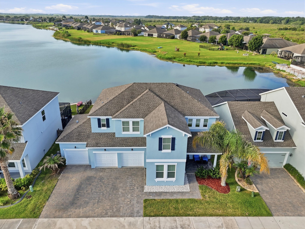
A Complete Media Project — With a Drone Story Worth Isolating
The full property was documented using multiple types of real estate media.
Photography showed the interiors and architectural details.
The floor plan explained the layout.
The 3D tour gave another way to explore the property.
Video showed movement and flow.
But none of those could create the perspective James specifically wanted from the exterior.
The Photo James Wanted Most
He wanted the boat and the house together in the same photograph.
That sounds simple until you look at the geography of the property.
From the ground, there was no position that could create the clean relationship between the boat, dock, water and home that he wanted.
The only real solution was to move the camera into the air.
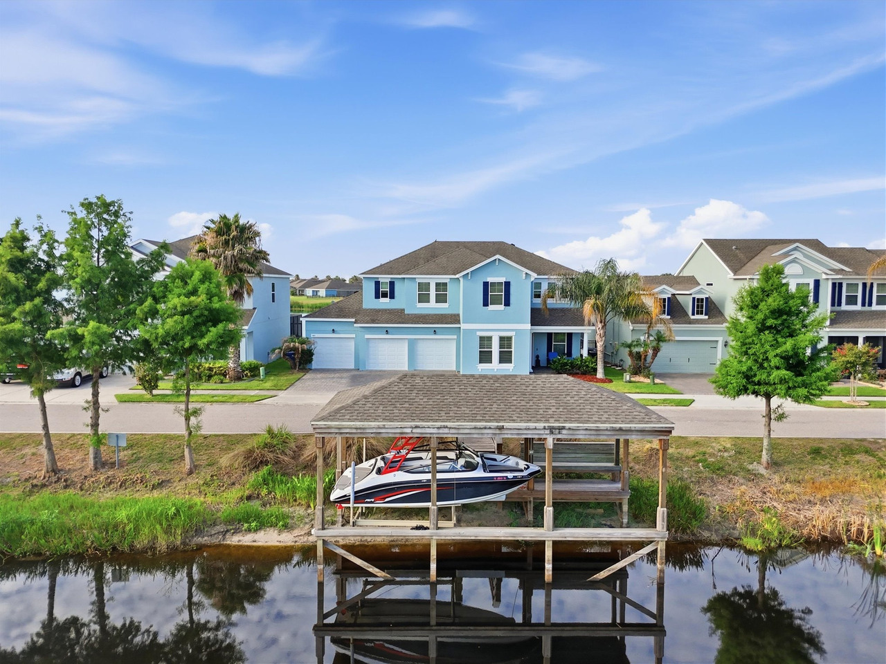
For me, this is exactly where drone photography earns its place in a real estate media package.
It is not because the camera is higher.
It is because the camera can finally stand somewhere that no photographer on the ground can stand.
Why That Image Works
The photograph does several jobs at once.
- It shows the actual waterfront position
- It connects the home to the dock
- It gives the boat a meaningful relationship to the property
- It communicates the scale of the water
- It shows the lifestyle without needing to manufacture anything
That is much stronger than simply photographing the roof from above.
The photograph gives the viewer a visual explanation of what living there can look like.
Ground-Level Photos Could Show the House. The Drone Showed the Context.
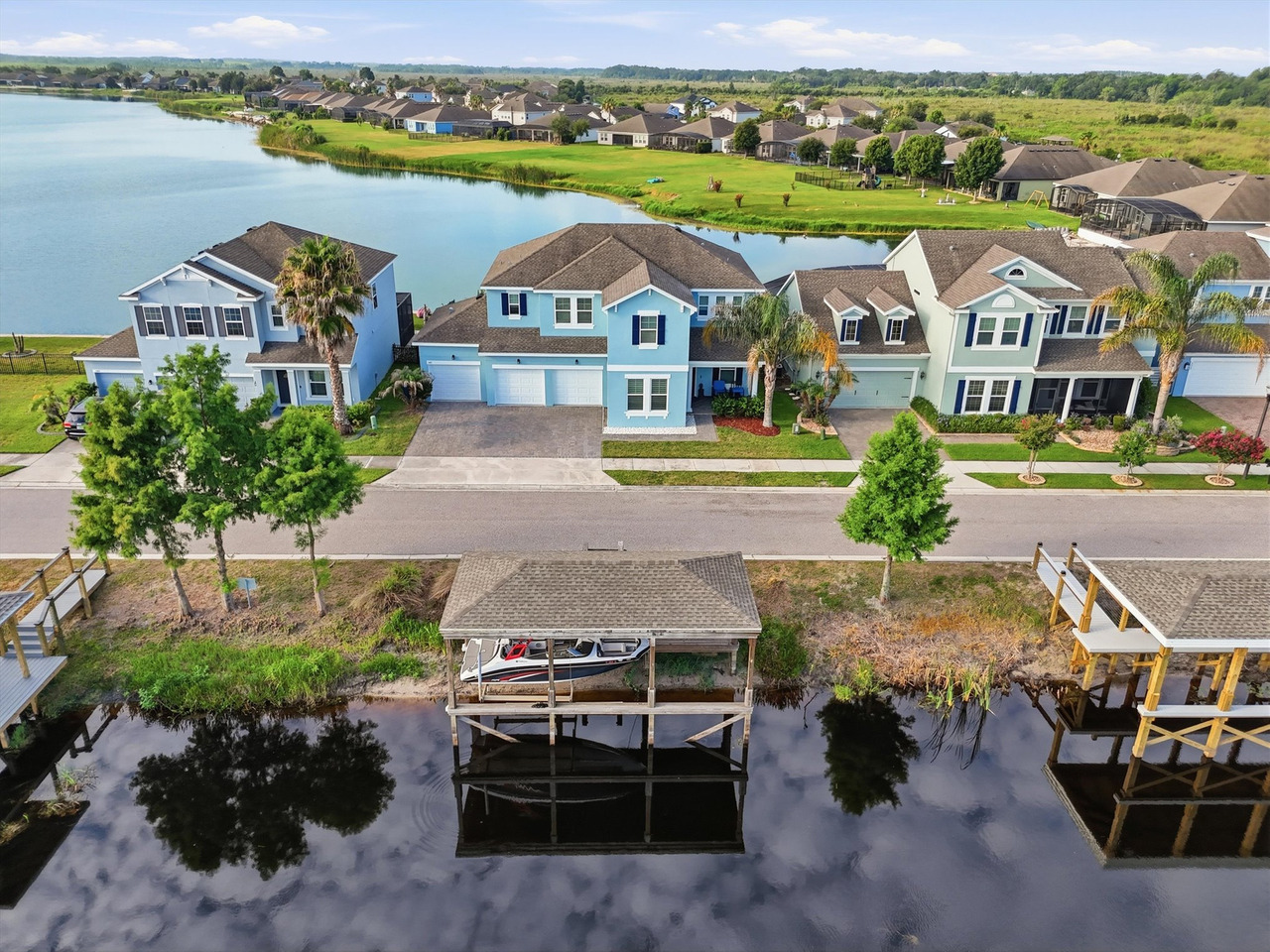
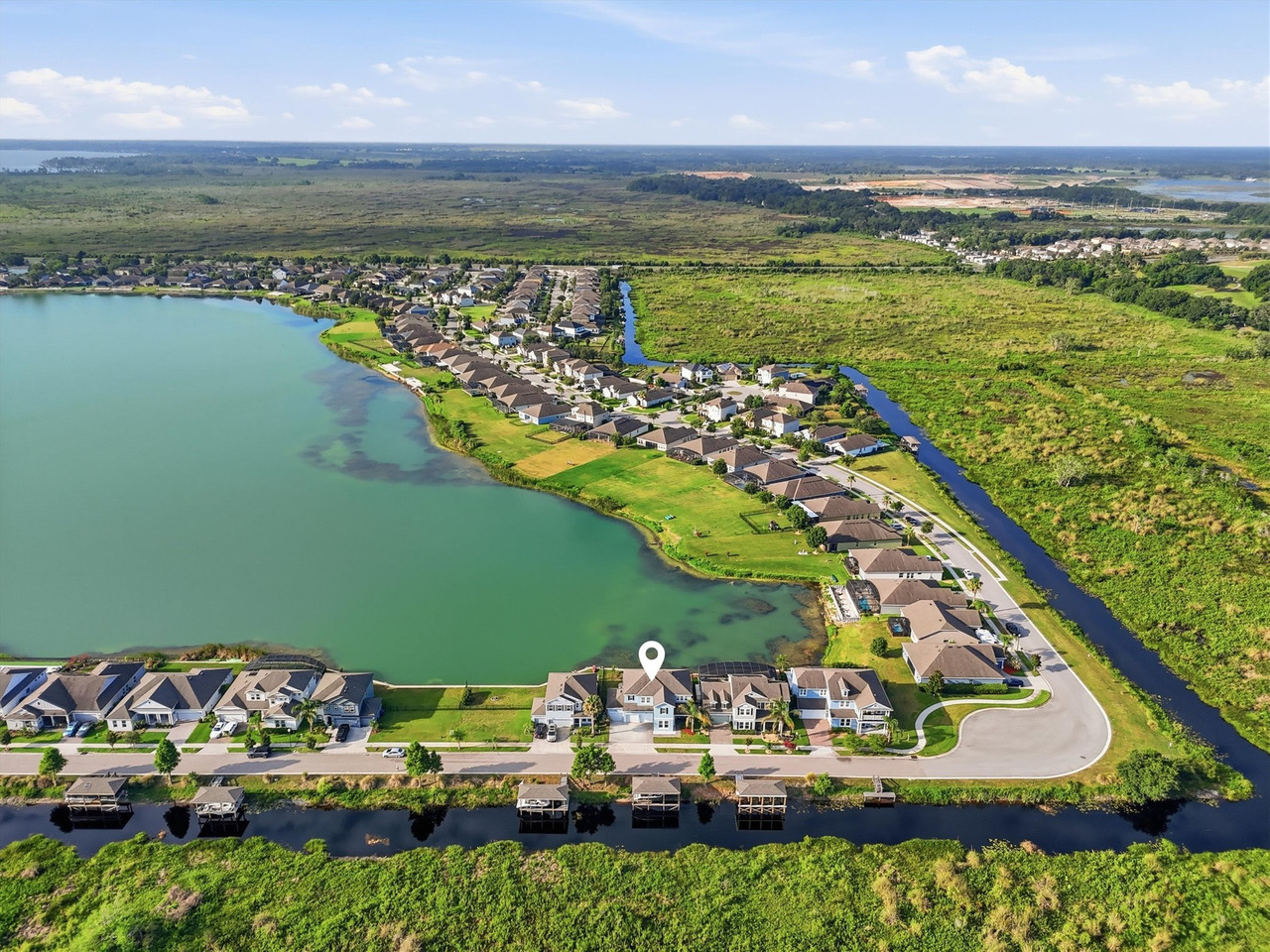
Once the drone was in the air, the property stopped being just a house with water behind it.
The larger story became visible.
- The lake behind the property
- The dock and water access
- The relationship between the home and shoreline
- The surrounding homes
- The community layout
- The clubhouse and amenity areas
Those relationships are difficult to communicate with isolated ground-level images.
The Drone Was Not There to Create Random Aerial Photos
The challenge in real estate drone photography is not getting the aircraft into the air.
It is deciding what the altitude should reveal.
Every important aerial needed to answer a question.
- How does the home relate to the lake?
- Where is the dock?
- How does the boat relate visually to the house?
- What surrounds the property?
- Where are the community amenities?
- What does the broader neighborhood context look like?
The height and camera angle should serve those questions.
Showing the Waterfront as Visual Evidence
A listing description can say “waterfront.”
But the word alone cannot show whether the water feels close, distant, private, open or visually connected to the property.
That is where aerial media becomes useful.
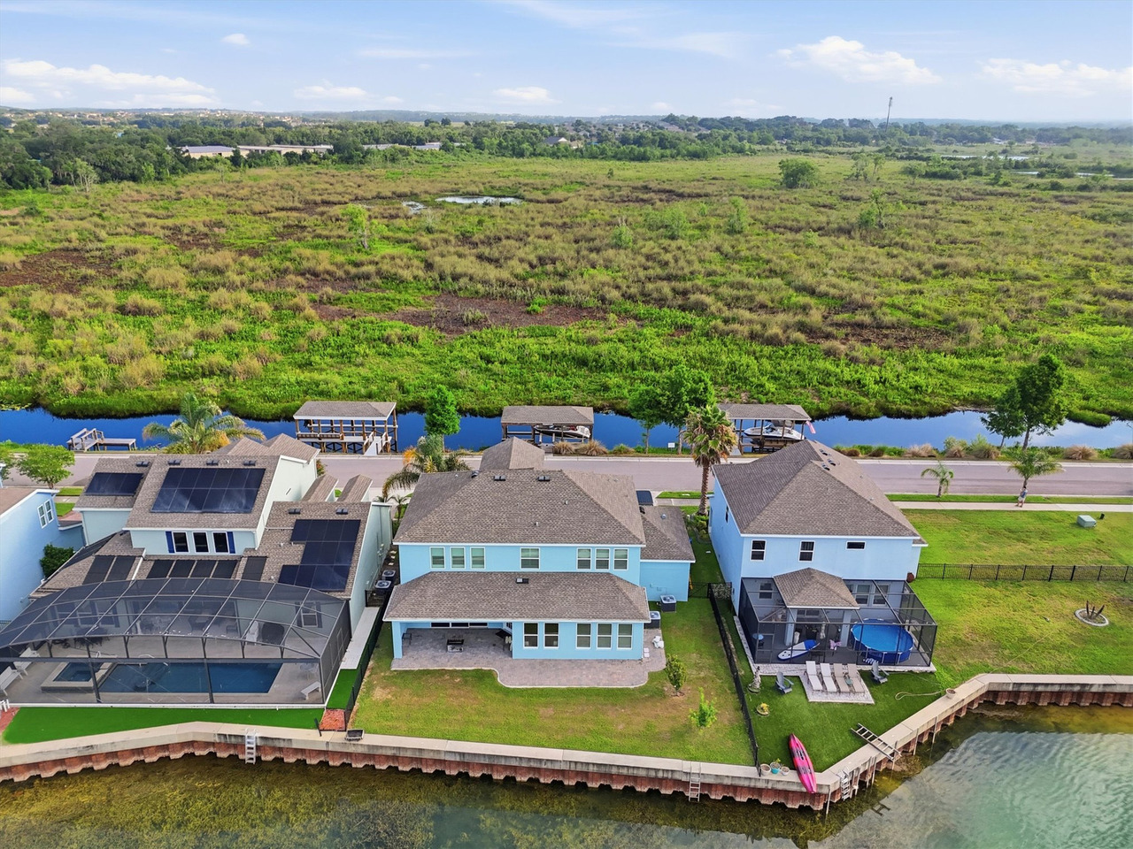
From this perspective, the viewer does not have to mentally assemble several separate photographs.
The location becomes understandable in one frame.
The Community Was Part of the Story Too
The property's surroundings extended beyond the lake.
The community also included amenities such as the clubhouse, pool, waterslide, sports courts, playground and green space.
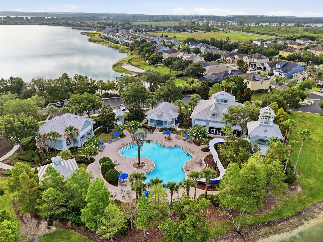
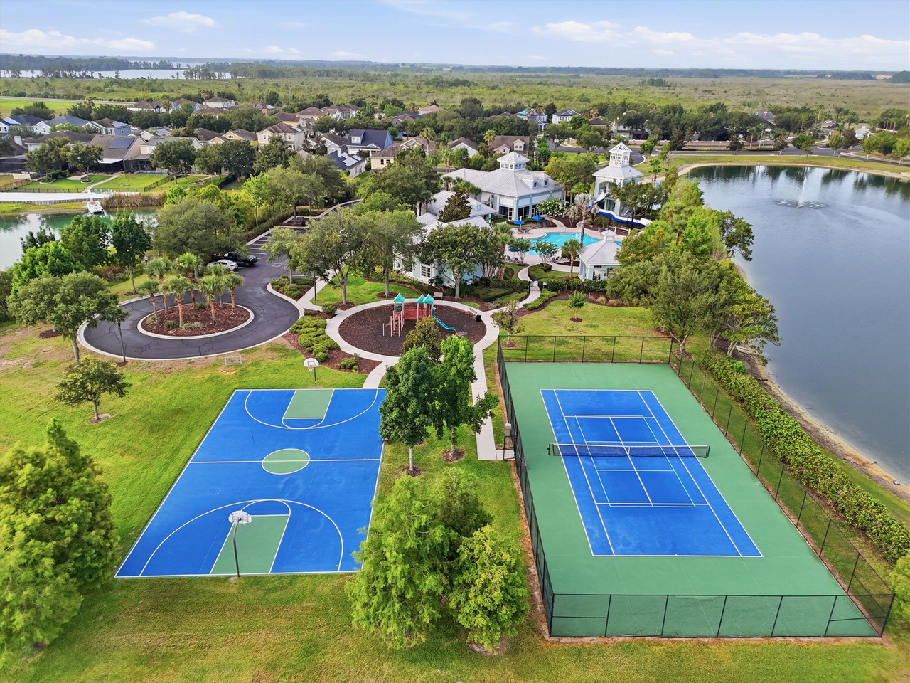
A standard amenity photograph can show a pool or clubhouse individually.
The aerial view shows how those elements connect to each other and to the larger community.
That is a different type of information.
And Then James Confirmed the Drone Had Done Its Job
The strongest proof did not come from a marketing statistic.
It came from the client.
“Great photos, great service. Drone footage turned out amazing. Highly recommend.”James Armstrong Google Review
That review is especially relevant to this case because James specifically mentions the drone work in his feedback.
The Flight Delay Was Also Part of the Work
The aerial portion of the project also had an operational complication.
The original drone flight could not be completed because of a temporary flight restriction, so the flight was postponed and completed when operations were permitted.
A professional drone decision is sometimes the decision not to launch.
The Most Important Lesson From This Project
This was a complete real estate media production.
The drone did not replace the photography.
It did not replace the video, floor plan or 3D tour.
It solved a different problem.
And in one specific image, it did something even more valuable: it gave James the exact relationship between his boat and his home that he wanted to preserve and present.
That single frame is a good example of why I do not think drone photography should be treated as an automatic add-on.
It should be used when the property gives the drone something meaningful to say.
When Drone Photography Adds Real Value
- Waterfront homes
- Properties with docks or boat access
- Acreage
- Golf frontage
- Conservation views
- Large or unusual lots
- Community amenities
- Properties where surroundings are part of the selling story
Start with the information the viewer needs, then decide whether an aerial view can add it.
Ask: “What can the aerial view explain that I cannot show from the ground?”
Frequently Asked Questions
Does drone photography replace regular real estate photography?
No. They perform different jobs. In this project, the home received complete media coverage. This article focuses specifically on what the aerial images contributed.
Why was drone photography important for this Groveland property?
The aerial perspective showed the relationship between the house, water, dock, boat and surrounding community in ways ground-level photography could not.
Why was the house-and-boat image so important?
The client specifically wanted the boat and the house presented together. The drone provided the camera position necessary to create that relationship cleanly in a single photograph.
When is drone photography most useful for a listing?
It becomes especially useful when location, waterfront access, acreage, golf frontage, conservation, a distinctive lot or community amenities are important parts of the property story.
Can drone photography help show neighborhood amenities?
Yes. Aerial photographs can show the scale and relationship between pools, clubhouses, sports areas, playgrounds, green spaces, lakes and nearby homes.
Does Your Property Have Something the Ground Can’t Show?
Waterfront, docks, acreage, conservation, golf frontage and community amenities often need a wider visual context.
See the drone service, review the portfolio or schedule your next real estate media session.

Gustavo Sousa
Gustavo Sousa is a professional real estate photographer, videographer and FAA Part 107 Certified Remote Pilot based in Winter Garden and serving the Greater Orlando and Central Florida area.
A professional photographer since 2012, he provides residential real estate photography, video, drone media, floor plans, 3D tours, vacation-home media and builder photography.
Share the property location and the relationships you need the aerial images to explain.
Discuss aerial coverage →

