
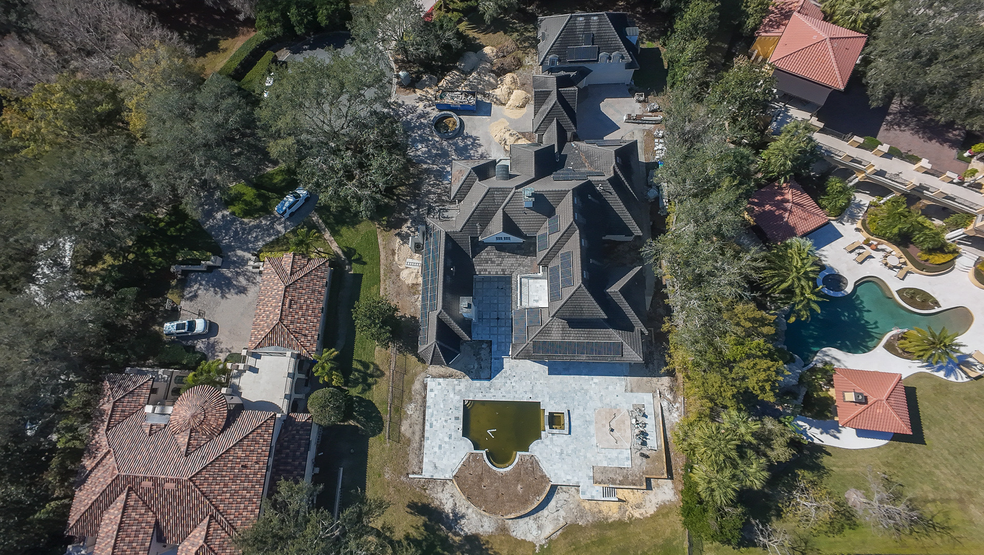
When I send a drone over a construction site or new development, I am not looking for the highest possible photograph.
I am looking for the altitude where the project finally becomes understandable.
From the ground, I may see one model home, one street, one row of lots or one amenity at a time.
From above, I can start seeing how those pieces relate to each other.
That is where drone photography becomes useful for builders and developers:
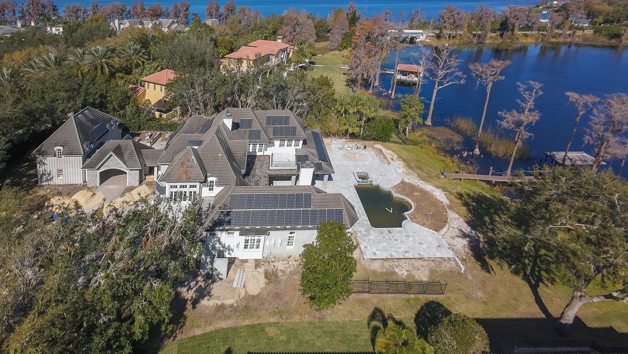
Construction Drone Photography Has More Than One Job
One of the problems with talking broadly about “construction drone photography” is that several completely different objectives get mixed together.
A builder documenting progress has a different need from a marketing director launching a community.
A developer trying to explain the scale of a project needs something different from someone promoting a finished clubhouse.
What is this aerial media supposed to accomplish?
Progress Documentation
Create a visual record of what the project looks like at a particular stage and make future comparisons easier.
Development Context
Show roads, phases, lots, model homes, amenities and the relationship between different areas of the development.
Builder Marketing
Create polished aerial images and video that can support websites, presentations, social media, advertising and community launches.
Amenities & Lifestyle
Show how pools, clubhouses, lakes, recreational areas and other community features connect to the broader project.
Progress Photography and Marketing Photography Are Not the Same Thing
This distinction matters.
If I am creating marketing photographs, I may wait for the light, adjust the composition and look for the angle that presents the development most clearly and attractively.
comparison.
If a team wants to understand what changed between visits, consistency becomes important.
For recurring documentation, it can make sense to establish several reference views and repeat them over time as closely as practical.
The objective is not to create a perfect duplicate every visit.
The objective is to make change easier to see.
Consistency gives the images more value over time.
- Identify the areas that matter before the first flight
- Establish useful reference directions
- Include enough surrounding context to understand change
- Document major phases deliberately instead of randomly
- Organize deliveries by project and date
- Keep marketing images separate from progress documentation when their purposes differ
What I Look for When Photographing a Development
The first thing I try to avoid is coming back with twenty aerial photographs that all say the same thing.
Going higher and rotating the drone a few degrees does not automatically create new information.
I am normally looking for relationships.
- How the main road enters the development
- Where the current construction phase sits within the larger project
- How completed homes relate to active construction
- Where model homes are positioned
- How amenities connect to residential areas
- Whether a lake, open space or natural feature matters to the community story
- How streets, lots and phases communicate the scale of the project
- Which perspective would be useful for marketing and which is better for documentation
The height of the drone is a creative decision, not the goal.
Sometimes a relatively low aerial angle is better because the model homes still feel important in the frame.
Other times I need more altitude because the real subject is the relationship between roads, lots, amenities and the overall development.
I want the altitude to answer the question—not just make the project look small from the sky.
Showing the Scale of a New Development
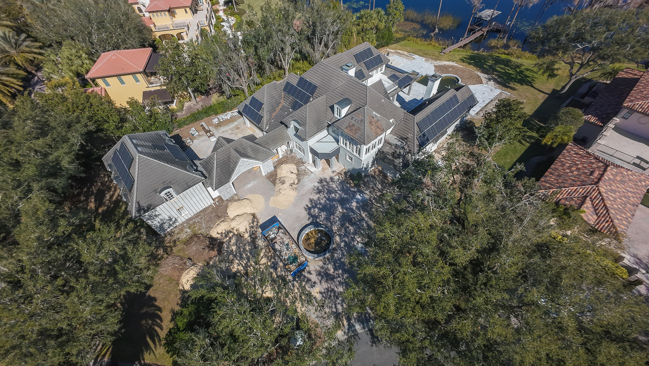
Scale is one of the clearest reasons to use an aerial perspective.
Standing on a street inside a development, I can show the homes around me.
What can be difficult from that position is explaining how large the project is or where those homes sit within the broader community.
Aerial photography can connect pieces that otherwise appear as separate images.
how they belong to the same development.
Drone Photography for Builder Marketing
Once the purpose shifts from documentation to marketing, I start making different decisions.
Now I care more about the visual hierarchy of the image.
What should the eye notice first?
Is the model home the subject?
Is it the entrance?
Is the community pool the feature we are trying to sell?
Or is the real story the scale of the development?
That is the same principle I use for residential listings.
I recently rewrote my broader drone guide around exactly this idea: a drone image should reveal information the ground photographs cannot.
Model Homes Need a Different Visual Strategy
A model home may sit inside a development, but that does not mean drone automatically becomes the most important media.
Sometimes the interior design, layout and finish selections are doing most of the marketing work.
That is exactly why I do not recommend building a media package around a checklist of services.
The project should determine the media.
On a model-home project I photographed in Palm Bay, the visual story was primarily inside the home.
The property was professionally staged and the objective was to create a polished library around the model itself.
For that project, photography, the 3D experience and floor plan were more important than adding drone simply because aerial media was available.
builders do not need more files—they need the right files for the job.
Amenities Can Be Part of the Development Story
For communities where the lifestyle extends beyond the home, amenities can become a significant part of the visual plan.
A ground-level photograph of the pool can show the pool beautifully.
Where is that pool in relation to everything else?
The same can apply to:
- Clubhouses
- Community pools
- Sports courts
- Lakes and water features
- Walking areas
- Community entrances
- Open space
- Model-home centers
Again, the aerial image should have a purpose.
One Drone Shoot Can Serve Different Teams—If We Plan It That Way
A construction or development shoot may eventually be seen by more people than the person who originally booked it.
Marketing may want polished images.
Ownership may want a broad view of current development.
A project team may want reference images of a specific area.
Those needs can overlap, but they are not identical.
The best time to tell the photographer what each team needs is before the flight—not after the gallery is delivered.
What Drone Photography Is Not
This is where I want to be precise.
I provide professional aerial photography and video.
I do not present standard aerial photography as something it is not.
Aerial photography is not automatically a land survey, engineering inspection, roof inspection, safety inspection or specialized mapping service.
A photograph can document what is visible from the camera.
If a project needs measurements, surveying, engineering analysis, thermal inspection, photogrammetry or another specialized technical deliverable, that needs to be defined separately and performed by the appropriate qualified provider.
Why I Removed the Big Statistics From the Old Version of This Article
The previous version of this page included claims about drones dramatically improving safety and creating enormous cost savings in construction.
I do not need those claims to explain why I use a drone.
They also create the wrong expectation about what I am selling.
I am selling professional visual communication from an aerial perspective.
That is a much clearer promise.
When Drone May Not Be the Priority
There are construction projects where the drone is extremely useful.
There are also moments where another type of photography may be more important.
- The current phase is primarily interior work
- The important details cannot be understood from the air
- The objective is to document finishes inside a model home
- The aerial view adds little new information
- Weather or airspace conditions prevent the planned operation
- The project needs specialized mapping rather than standard photography
I would rather define that before the shoot than deliver aerial images nobody actually needs.
Construction Progress vs. Marketing: The Quick Comparison
Before a Construction Drone Shoot, I Want These Answers
A short briefing can completely change the usefulness of the final gallery.
- What is the project address?
- What phase is currently under construction?
- Is the goal documentation, marketing or both?
- Which parts of the site matter most?
- Are there specific roads, lots, buildings or amenities that must appear?
- Is this a one-time shoot or part of recurring progress coverage?
- Who will use the final media?
- Are horizontal images, vertical content or aerial video needed?
- What is the delivery deadline?
- Is there a site contact I should coordinate with before arrival?
That information gives me something far more useful than:
An Active Construction Site Changes the Flight Planning
Construction sites are dynamic environments.
There may be workers, cranes, moving vehicles, temporary equipment and areas that are safe one day and different the next.
That means part of the job happens before I press record.
Commercial Drone Operations
Magic Lens aerial work is performed by an FAA Part 107 Certified Remote Pilot.
Before a commercial flight, I evaluate the location, airspace and operational conditions.
Controlled airspace may require FAA authorization, and active sites also require practical coordination around people, vehicles, obstacles and safe areas for the operation.
If the planned flight cannot be completed safely and legally under the conditions on site, I do not treat getting the image as more important than the operation itself.
The Weather Does Not Care About the Construction Schedule
This is another reality of aerial work in Central Florida.
A scheduled project milestone does not guarantee flyable weather.
Wind, rain, storms, visibility and rapidly changing conditions can affect when the aerial portion of a shoot can happen.
For marketing images, I may also care about light direction and sky conditions.
For progress coverage, matching the documentation schedule may be more important than waiting for a dramatic sunset.
The purpose of the shoot determines what “good conditions” actually means.
Do Builders Need Drone Video Too?
Sometimes.
A still aerial photograph is excellent when the viewer needs time to study the site.
Video is different.
Movement can help introduce the project, reveal scale gradually and transition between an entrance, model homes, active phases and amenities.
That can be particularly useful for:
- Builder websites
- Community launch videos
- Social media
- Marketing presentations
- Development updates
- Sales-center displays
But I would not add video automatically.
First I want to know where it will be used.
Construction Photography Does Not Stop at the Drone
A developer may need aerial context today and finished model-home interiors next month.
A builder may need community exteriors, clubhouse coverage, lifestyle images or photography once the project is complete.
That is why I think of this less as a “drone service” and more as a broader visual documentation problem.
What I Want the Final Aerial Image to Do
Whether I am photographing a residential listing or a development, my standard is similar.
I want the image to give the viewer information they could not understand as clearly from the ground.
For builders and developers, that question becomes even more important because the project is often much larger than one house.
Frequently Asked Questions
What is construction progress drone photography?
It is aerial photography used to visually document a construction project at a particular stage. When coverage is repeated over time, consistent reference views can make visible changes easier to compare.
Can drone photography be used to market a new development?
Yes. Aerial photography can help show community scale, roads, model homes, amenities, lakes, entrances and other relationships that may be difficult to explain with ground-level images alone.
Is construction drone photography the same as surveying or mapping?
No. Standard aerial photography should not be treated as a legal survey, engineering analysis or specialized mapping service. Those deliverables require the appropriate workflow and qualified provider.
Can you photograph the same construction project regularly?
Yes. Recurring coverage can be planned around project milestones or an agreed schedule. If comparison is important, reference angles and key areas should be identified early so future coverage remains useful.
Can drone photography show community amenities?
Yes. When amenities are important to the project story, aerial imagery can help show both the amenity itself and how it relates to homes, roads and the larger development.
Can a drone always fly at a construction site?
No. Airspace, weather, site conditions, people, obstacles and other operational restrictions can affect whether a flight can be completed safely and legally at the planned time.
Do I need both ground photography and drone photography?
Often they answer different questions. Ground photography can document architecture, materials, model homes and details. Drone photography is strongest when the project also needs scale, site relationships or broader context.
What information should I send before requesting a quote?
Send the project address, current phase, purpose of the imagery, areas that must be documented, expected frequency if recurring coverage is needed and how the final images or video will be used.
Need Aerial Media for a Construction Project or New Development?
Send me the project address, current phase and what the images need to accomplish. I can help define the right coverage for progress documentation, builder marketing, amenities, model-home communities or broader development context.
Construction and development projects are quoted individually based on scope, location, deliverables and whether recurring coverage is needed.

Gustavo Sousa
Gustavo Sousa is a professional photographer, videographer and FAA Part 107 Certified Remote Pilot based in Winter Garden, Florida.
A professional photographer since 2012, he works with builders, developers, Realtors and real estate media projects throughout Orlando and Central Florida.
Reference
Federal Aviation Administration — Part 107
FAA information for commercial drone operators and Part 107 operations
